Request A Quote


Topographical / 3D Mapping

topographical web

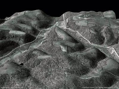
Topographic maps are used for a wide range of applications, from camping, canoeing, hunting and fishing, urban planning, resource development and mapping

Read more...

Lot-Split / Subdivision determination

lesson 1 image 7

A lot split is the legal division of any lot into two or more lots, for the purpose of sale, lease or financing, now or in the future.

Stay Informed!

Sign Up Now

Other Services:

  • Lot-Split / Subdivision determination
  • Platting
  • Topographical / 3-D Mapping
  • Accident Surveying / Mapping
  • Expert Witness / Public Testimony

Current News!!

Effective Today! The 2016 Revisions to the ALTA/NSPA Land Title surveys are in effect.

Click to DOWNLOAD your copy.

My Clients

McKinley, Inc.
Old Republic Title Insurance Co.
Kamco Property Company
Concord Management Limited
Linkscorp Florida Windermere, LLC
Eastwood Golf Club, LLC
Lowndes, Drosdick, Doster, Kantor &  Reed, P.A.
Fixel, Maguire & Willis
Wilson, Garber & Small, PA
LCA & Associates
Stanton And Gasdick, P.A.
Century 21 Associates
Bankers Capital Credit
Sun Belt Title Agency
& Individual Residential Realtors

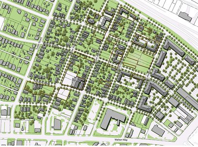
Planning & Zoning Impacts

planning

On commercial and vacant land surveys this optional requirement is critical to de-termine the buildable area of a parcel of land. The 

Read More

Permitting Uses

images 1

The final Map of Survey may be used for many governmental permitting uses
 

Flood Elevation Certification

flood elevation2

This is an optional service we offer to both residential and commercial clients.

Read More


Go to top